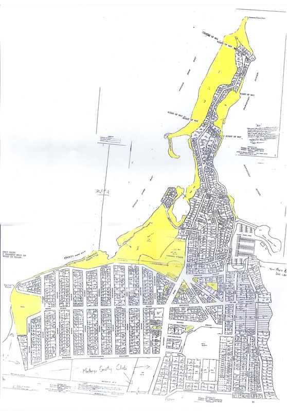
This map has been provided by the officers of CFPIA to help residents understand the layout of Common Fence Point. The areas highlighted in yellow indicate the land held in Trust by the Common Fence Point Improvement Association which was established in 1926 through a deed from the Henry A. Brown Corporation. Questions can be directed to the Officers or Trustees – click here for contact information. PDF and JPG versions of this document are included below and may be downloaded and saved by interested parties.

